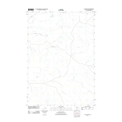
2012 Map of La Plant SW
USGS Topo · Published 2012About this map
Agneau Ranch and HTriangle Ranch sit within the sparse, drainage-heavy landscape of Dewey County during the early 21st century. The terrain is defined by a complex network of intermittent waterways that feed into larger systems, including Virgin Cr and Stove Cr in the northern half of the quadrangle. Further south, the map details the headwaters of the Willow Creek system, split between E Br Willow Cr and W Br Willow Cr. This area of the Cheyenne River Reservation shows a transition toward more centralized ranching operations, with CO Hwy-15h providing the primary transit corridor across the northern plains. The detailed mapping of small local features like Parkers Cr, No Heart Cr, and Scatter Butte Cr provides a precise record of the traditional land-use patterns and seasonal hydrology in this part of South Dakota.
Find a feature on this map
10 named features on this map. Tap any name to fly to it.
Don’t see what you’re looking for? This feature index may not catch every label — zoom into the map to look around manually.
Map Details
Editions of this 2012 La Plant SW Map
This is the sole edition of this map. No revisions or reprints were ever made.
Other maps of this area

1951 · Virginia
USGS Topo · 1:24,000

1951 · Ridgeview NE
USGS Topo · 1:24,000

1951 · La Plant
USGS Topo · 1:24,000

1953 · McIntosh
USGS Topo · 1:250,000

1954 · Pierre
USGS Topo · 1:250,000

1958 · Pierre
USGS Topo · 1:250,000

1958 · McIntosh
USGS Topo · 1:250,000

1981 · Charlie Creek
USGS Topo · 1:24,000
1981 · No Heart Creek NE
USGS Topo · 1:24,000
1981 · Stove Creek
USGS Topo · 1:24,000