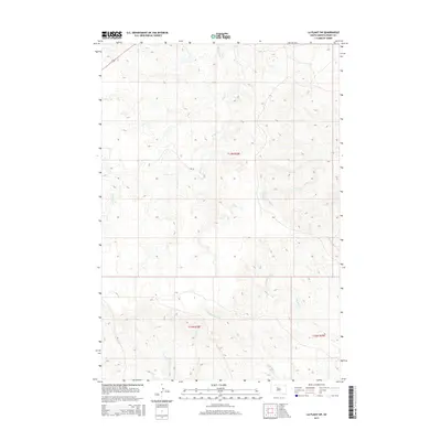
2015 Map of La Plant SW
USGS Topo · Published 2015About this map
The rolling grasslands of Dewey County are defined by a complex drainage network feeding into the Cheyenne River watershed. Virgin Cr meanders across the northern and central sections of this township, its winding course carving subtle valleys into the high plains. Further south, the terrain becomes more broken as Stove Cr and Parkers Cr intersect the landscape, highlighting the dendritic drainage patterns characteristic of this part of South Dakota.
Find a feature on this map
11 named features on this map. Tap any name to fly to it.
Don’t see what you’re looking for? This feature index may not catch every label — zoom into the map to look around manually.
Map Details
Editions of this 2015 La Plant SW Map
This is the sole edition of this map. No revisions or reprints were ever made.
Other maps of this area

1951 · Virginia
USGS Topo · 1:24,000

1951 · Ridgeview NE
USGS Topo · 1:24,000

1951 · La Plant
USGS Topo · 1:24,000

1953 · McIntosh
USGS Topo · 1:250,000

1954 · Pierre
USGS Topo · 1:250,000

1958 · Pierre
USGS Topo · 1:250,000

1958 · McIntosh
USGS Topo · 1:250,000

1981 · Charlie Creek
USGS Topo · 1:24,000
1981 · No Heart Creek NE
USGS Topo · 1:24,000
1981 · Stove Creek
USGS Topo · 1:24,000