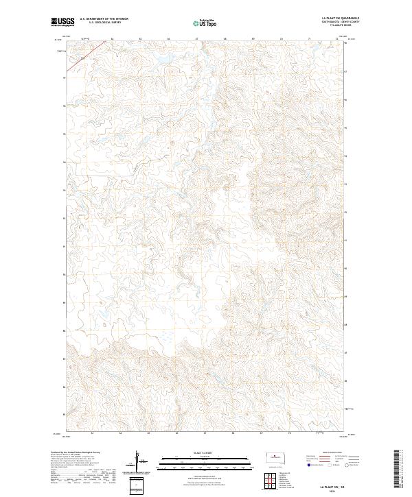
2021 Map of La Plant SW
USGS Topo · Published 2021About this map
The rolling grasslands of eastern Dewey County are defined by a complex drainage system flowing toward the Missouri River basin. This landscape is characterized by the convergence of several major creek branches, most notably Virgin Cr which meanders through the northwestern townships. The terrain is marked by the distinct watershed divide between Stove Cr and No-Heart Cr, reflecting the natural topography of the Missouri Plateau. A single improved corridor, Co Rd 15g, provides the primary access through this rangeland, where the Public Land Survey System grids out Township 13 North and Township 12 North. The presence of Scatter Butte Cr and the dual branches of W Br Willow Cr and E Br Willow Cr illustrate the intricate erosional patterns typical of this portion of South Dakota.
Find a feature on this map
12 named features on this map. Tap any name to fly to it.
Don’t see what you’re looking for? This feature index may not catch every label — zoom into the map to look around manually.
Map Details
Editions of this 2021 La Plant SW Map
This is the sole edition of this map. No revisions or reprints were ever made.
Other maps of this area

1951 · Virginia
USGS Topo · 1:24,000

1951 · Ridgeview NE
USGS Topo · 1:24,000

1951 · La Plant
USGS Topo · 1:24,000

1953 · McIntosh
USGS Topo · 1:250,000

1954 · Pierre
USGS Topo · 1:250,000

1958 · Pierre
USGS Topo · 1:250,000

1958 · McIntosh
USGS Topo · 1:250,000

1981 · Charlie Creek
USGS Topo · 1:24,000
1981 · No Heart Creek NE
USGS Topo · 1:24,000
1981 · Stove Creek
USGS Topo · 1:24,000