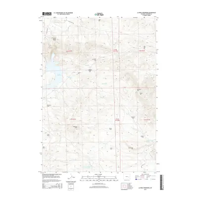
2015 Map of La Prele Reservoir
USGS Topo · Published 2015About this map
La Prele Reservoir serves as a central hydrological feature in this high-plains landscape, where the La Prele Main Canal and La Prele Cr manage water across a terrain defined by significant draws and peaks. The map reveals an area where name-bearing landmarks often denote family heritage or early homesteading, such as Johnson Mailbox Hill, Wilson Draw, and Whitaker Draw. Cattle and sheep ranching history is evidenced by the namesake Sheep Mtn and the Wilson Sheep Cr Number 1 Reservoir.
Find a feature on this map
45 named features on this map. Tap any name to fly to it.
Don’t see what you’re looking for? This feature index may not catch every label — zoom into the map to look around manually.
Map Details
Editions of this 2015 La Prele Reservoir Map
This is the sole edition of this map. No revisions or reprints were ever made.
Other maps of this area

1949 · Orpha
USGS Topo · 1:24,000

1949 · Careyhurst
USGS Topo · 1:24,000

1949 · Poison Lake
USGS Topo · 1:24,000

1949 · Douglas
USGS Topo · 1:24,000

1949 · Chalk Buttes
USGS Topo · 1:24,000

1950 · Careyhurst
USGS Topo · 1:24,000

1950 · Poison Lake
USGS Topo · 1:24,000

1950 · Douglas
USGS Topo · 1:24,000

1950 · Orpha
USGS Topo · 1:24,000
1950 · Chalk Buttes
USGS Topo · 1:24,000