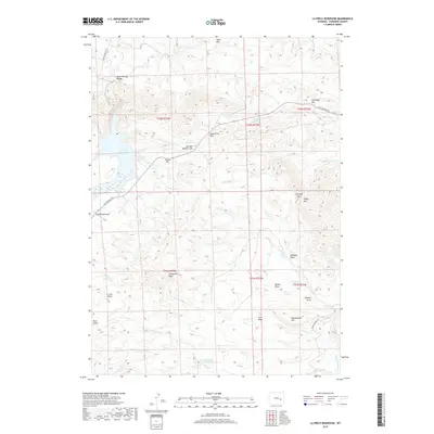
2017 Map of La Prele Reservoir
USGS Topo · Published 2017About this map
La Prele Reservoir serves as the central water feature in this high-plains landscape of Converse County, where the drainage network of Dull Knife Cr and Bed Tick Cr cuts through the Wyoming terrain. The presence of Ayres Natural Bridge in the northwest corner highlights a significant geological landmark, while family-named features like Johnson Mailbox Hill and Stinson Hill suggest the enduring legacy of local ranching and homesteading families.
Find a feature on this map
41 named features on this map. Tap any name to fly to it.
Don’t see what you’re looking for? This feature index may not catch every label — zoom into the map to look around manually.
Map Details
Editions of this 2017 La Prele Reservoir Map
This is the sole edition of this map. No revisions or reprints were ever made.
Other maps of this area

1949 · Orpha
USGS Topo · 1:24,000

1949 · Careyhurst
USGS Topo · 1:24,000

1949 · Poison Lake
USGS Topo · 1:24,000

1949 · Douglas
USGS Topo · 1:24,000

1949 · Chalk Buttes
USGS Topo · 1:24,000

1950 · Careyhurst
USGS Topo · 1:24,000

1950 · Poison Lake
USGS Topo · 1:24,000

1950 · Douglas
USGS Topo · 1:24,000

1950 · Orpha
USGS Topo · 1:24,000
1950 · Chalk Buttes
USGS Topo · 1:24,000