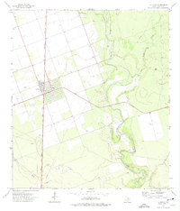
1972 Map of La Pryor
USGS Topo · Published 1975About this map
The settlement of La Pryor serves as the focal point of this South Texas survey, situated at the intersection of a grid-patterned townsite and the Missouri Pacific railroad. The surrounding landscape of Zavala County is defined by the meandering course of the Nueces River, which carves a path through the eastern portion of the quadrangle. This riparian corridor contrasts sharply with the western plains, where numerous wells and irrigation networks suggest the intensive agricultural development of the early 1970s.
Find a feature on this map
14 named features on this map. Tap any name to fly to it.
Don’t see what you’re looking for? This feature index may not catch every label — zoom into the map to look around manually.
Map Details
Editions of this 1972 La Pryor Map
This is the sole edition of this map. No revisions or reprints were ever made.
Other maps of this area

1898 · Uvalde
USGS Topo · 1:125,000

1899 · Uvalde
USGS Topo · 1:125,000

1939 · La Pryor
USGS Topo · 1:62,500

1953 · Crystal City
USGS Topo · 1:250,000

1954 · San Antonio
USGS Topo · 1:250,000

1955 · Crystal City
USGS Topo · 1:250,000

1957 · San Antonio
USGS Topo · 1:250,000

1957 · Batesville
USGS Topo · 1:62,500

1960 · Pulliam Ranch
USGS Topo · 1:24,000
1960 · Sand Mountain
USGS Topo · 1:24,000