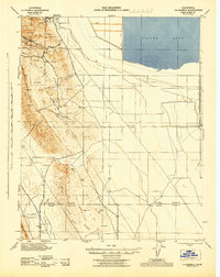
1943 Map of La Rambla
USGS Topo · Published 1943About this map
Tulare Lake dominates the northeastern corner of this 1943 landscape, bounded by the Conn Levee and Liberty Farms West Side Levee. The terrain is characterized by the dramatic rise of the Kettleman Hills, featuring a series of structural highs including North Dome, Middle Dome, and South Dome. These geologic features define the region's industrial character, with numerous oil extraction sites marked across the ridges. Between these heights and the Jasmin Hills lies the broad Kettleman Plain, a corridor of flat land that contrasts with the dissected slopes of Mustang Hill and Broken Hill. Small settlements and landmarks like Devils Den, Los Medanos, and La Lomica are scattered throughout, often situated near the complex network of arroyos such as Arroyo Robador and Arroyo Recodo that drain the arid highlands toward the basin floor.
Find a feature on this map
54 named features on this map. Tap any name to fly to it.
Don’t see what you’re looking for? This feature index may not catch every label — zoom into the map to look around manually.
Map Details
Editions of this 1943 La Rambla Map
This is the sole edition of this map. No revisions or reprints were ever made.
Other maps of this area

1912 · Coalinga
USGS Topo · 1:125,000

1914 · Lost Hills
USGS Topo · 1:125,000

1914 · Cholame
USGS Topo · 1:125,000

1915 · Cholame
USGS Topo · 1:125,000

1917 · Cholame
USGS Topo · 1:125,000

1930 · Discovery Well
USGS Topo · 1:31,680

1930 · Avenal Gap
USGS Topo · 1:31,680

1930 · Kettleman Plain
USGS Topo · 1:31,680

1930 · Middle Dome
USGS Topo · 1:31,680

1931 · Harvester
USGS Topo · 1:31,680