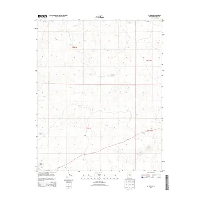
2013 Map of La Rendija
USGS Topo · Published 2013About this map
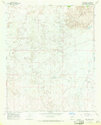
La Rendija and the surrounding high desert of the Eastern Navajo Agency are defined by a sparse network of ranching outposts and vital water sources in this 2013 survey. The landscape is dotted with named locations such as Julian Place and Monte Seco, which speak to the historic human presence and land use in this arid region of Cibola County. Strategic water management is evident through features like Luis Well, Laguna Macho, and Tanque Pendejo, which serve as critical infrastructure for the livestock and wildlife that inhabit these plains. The terrain transitions from the open expanse of The Vega in the north to the prominent elevation of Cerro Gatos in the southwest. Transport through the area is largely facilitated by NM-117 and Co Road 42, providing the primary links between these remote ranching sites and the broader New Mexico road network.
Find a feature on this map
15 named features on this map. Tap any name to fly to it.
Don’t see what you’re looking for? This feature index may not catch every label — zoom into the map to look around manually.
Map Details
Editions of this 2013 La Rendija Map
This is the sole edition of this map. No revisions or reprints were ever made.
Other maps of this area

1954 · Saint Johns
USGS Topo · 1:250,000

1957 · Saint Johns
USGS Topo · 1:250,000

1958 · Saint Johns
USGS Topo · 1:250,000

1962 · Saint Johns
USGS Topo · 1:250,000
1967 · Ice Caves SE
USGS Topo · 1:24,000
1967 · York Ranch SE
USGS Topo · 1:24,000
1967 · Cerro Brillante
USGS Topo · 1:24,000

1967 · Cerro Alto
USGS Topo · 1:24,000
1967 · York Ranch
USGS Topo · 1:24,000

1967 · Veteado Mountain
USGS Topo · 1:24,000