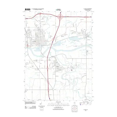
2012 Map of La Salle
USGS Topo · Published 2012About this map
The Illinois River corridor defines this landscape, where industrial development and educational institutions meet the dramatic geology of the Vermilion River valley. Near the confluence, the city of Oglesby serves as a central hub, flanked by the residential area of Jonesville and the distinct elevation of Piety Hill. The map documents a significant concentration of local heritage sites, including Saint Hyacinth Cem and Oakwood Memorial Cem, alongside modern landmarks like the La Salle Speedway. Higher education is well-represented by Illinois Valley Community College and Lasalle-Peru-Oglesby Junior College. To the east, the terrain transitions toward the natural features of Matthiessen State Park and the sandstone formations near Saint Louis Canyon, providing a detailed look at how the region's topography has shaped both recreation and settlement.
Find a feature on this map
103 named features on this map. Tap any name to fly to it.
Don’t see what you’re looking for? This feature index may not catch every label — zoom into the map to look around manually.
Map Details
Editions of this 2012 La Salle Map
This is the sole edition of this map. No revisions or reprints were ever made.
Other maps of this area

1892 · Ottawa
USGS Topo · 1:62,500

1893 · Lasalle
USGS Topo · 1:62,500

1911 · La Salle
USGS Topo · 1:62,500

1913 · La Salle
USGS Topo · 1:62,500

1915 · Ottawa
USGS Topo · 1:62,500

1925 · Streator
USGS Topo · 1:62,500

1927 · Streator
USGS Topo · 1:62,500

1934 · Wenona
USGS Topo · 1:48,000

1939 · Wenona
USGS Topo · 1:62,500

1946 · Ottawa
USGS Topo · 1:62,500