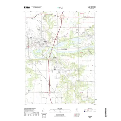
2018 Map of La Salle
USGS Topo · Published 2018About this map
The Illinois River corridor is the defining axis of this landscape, where industrial heritage meets protected natural areas. Flanked by the interconnected cities of Peru and LaSalle, the river valley transitions into the Illinois and Michigan Canal National Heritage Corridor, preserving the remnants of the waterway that originally linked the Great Lakes to the Mississippi. To the south, Oglesby and Jonesville overlook the winding Vermilion River, while the campus of Illinois Valley Community College sits on the bluffs above the valley. Local history is recorded in the placement of numerous burial grounds including Saint Hyacinth Cem and Saint Vincent Cem, alongside the rugged relief of Saint Louis Canyon and the prominent Plum Island near Utica.
Find a feature on this map
106 named features on this map. Tap any name to fly to it.
Don’t see what you’re looking for? This feature index may not catch every label — zoom into the map to look around manually.
Map Details
Editions of this 2018 La Salle Map
This is the sole edition of this map. No revisions or reprints were ever made.
Other maps of this area

1892 · Ottawa
USGS Topo · 1:62,500

1893 · Lasalle
USGS Topo · 1:62,500

1911 · La Salle
USGS Topo · 1:62,500

1913 · La Salle
USGS Topo · 1:62,500

1915 · Ottawa
USGS Topo · 1:62,500

1925 · Streator
USGS Topo · 1:62,500

1927 · Streator
USGS Topo · 1:62,500

1934 · Wenona
USGS Topo · 1:48,000

1939 · Wenona
USGS Topo · 1:62,500

1946 · Ottawa
USGS Topo · 1:62,500