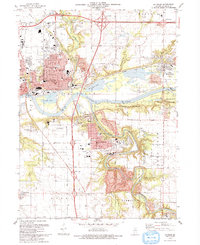
1993 Map of La Salle
USGS Topo · Published 1993About this map
The Illinois River corridor anchors this detailed survey of north-central Illinois, where the historic Michigan and Illinois Canal runs parallel to the waterway through Utica. This landscape is defined by the dramatic confluence of the Vermilion River and its various tributaries, which carve through the terrain to reach the main river valley. Industrial and institutional footprints are prominent, from the Cement Plant and numerous quarries near Oglesby to the Illinois Valley Community College campus south of La Salle.
Find a feature on this map
59 named features on this map. Tap any name to fly to it.
Don’t see what you’re looking for? This feature index may not catch every label — zoom into the map to look around manually.
Map Details
Editions of this 1993 La Salle Map
This is the sole edition of this map. No revisions or reprints were ever made.
Other maps of this area

1892 · Ottawa
USGS Topo · 1:62,500

1893 · Lasalle
USGS Topo · 1:62,500

1911 · La Salle
USGS Topo · 1:62,500

1913 · La Salle
USGS Topo · 1:62,500

1915 · Ottawa
USGS Topo · 1:62,500

1925 · Streator
USGS Topo · 1:62,500

1927 · Streator
USGS Topo · 1:62,500

1934 · Wenona
USGS Topo · 1:48,000

1939 · Wenona
USGS Topo · 1:62,500

1946 · Ottawa
USGS Topo · 1:62,500