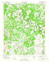
1952 Map of La Vergne
USGS Topo · Published 1965About this map
Stones River meanders sharply through this mid-century landscape, carving deep bends like Neil Bend as it flows north toward the Davidson and Wilson County lines. The settlement of La Vergne serves as a focal point in the south, positioned along the Nashville Chattanooga and St Louis Railway and the Murfreesboro Pike. This 1950s survey documents a rural community in transition, where family landmarks and small country schools like Morrow Headden Sch and Union Sch are still prominent features.
Find a feature on this map
60 named features on this map. Tap any name to fly to it.
Don’t see what you’re looking for? This feature index may not catch every label — zoom into the map to look around manually.
Map Details
Editions of this 1952 La Vergne Map
2 editions found
Other maps of this area

1903 · Nashville
USGS Topo · 1:125,000

1916 · Murfreesboro
USGS Topo · 1:62,500

1932 · Hermitage
USGS Topo · 1:62,500

1942 · Lebanon
USGS Topo · 1:100,000

1950 · Walterhill
USGS Topo · 1:24,000

1951 · Martha
USGS Topo · 1:24,000

1952 · Hermitage
USGS Topo · 1:24,000

1952 · La Vergne
USGS Topo · 1:24,000

1952 · Nashville East
USGS Topo · 1:24,000

1952 · Antioch
USGS Topo · 1:24,000