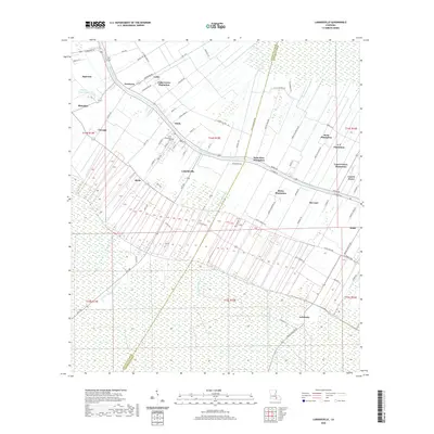
2020 Map of Labadieville
USGS Topo · Published 2020About this map
Bayou Lafourche dictates the layout of the landscape in this section of Assumption and Lafourche Parishes, where settlement and commerce historically clung to the fertile riverbanks. This 2020 map documents the persistent identity of numerous named plantations, including Cedar Grove Plantation, Saint Rose Plantation, and White Plantation, which define the agricultural boundary between the river and the surrounding marshy Lowlands. The town of Labadieville serves as a central hub, anchored by the Saint Philomena Cem and connected to nearby hamlets like Chula and Freetown.
Find a feature on this map
86 named features on this map. Tap any name to fly to it.
Don’t see what you’re looking for? This feature index may not catch every label — zoom into the map to look around manually.
Map Details
Editions of this 2020 Labadieville Map
This is the sole edition of this map. No revisions or reprints were ever made.
Other maps of this area

1892 · Gibson
USGS Topo · 1:62,500

1892 · Thibodaux
USGS Topo · 1:62,500

1897 · Gibson
USGS Topo · 1:62,500

1927 · Thibodaux NW
USGS Topo · 1:31,680

1932 · Thibodaux NE
USGS Topo · 1:31,680

1932 · Thibodaux SE
USGS Topo · 1:31,680

1932 · Thibodaux SW
USGS Topo · 1:31,680

1935 · Morgan City
USGS Topo · 1:62,500

1938 · Labadieville
USGS Topo · 1:24,000
1938 · Lafourche
USGS Topo · 1:24,000