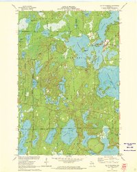
1971 Map of Lac Du Flambeau
USGS Topo · Published 1973This historical map portrays the area of Lac Du Flambeau in 1971, primarily covering Vilas County as well as portions of Oneida County and Iron County. Featuring a scale of 1:24000, this map provides a highly detailed snapshot of the terrain, roads, buildings, counties, and historical landmarks in the Lac Du Flambeau region at the time. Published in 1973, it is one of 3 known editions of this map due to revisions or reprints.
Find a feature on this map
55 named features on this map. Tap any name to fly to it.
Don’t see what you’re looking for? This feature index may not catch every label — zoom into the map to look around manually.
Map Details
Editions of this 1971 Lac Du Flambeau Map
3 editions found
Historical Maps of Iron County Through Time
36 maps found

1938 Phelps
Vilas County, WI

1939 Trout Lake
Vilas County, WI

1939 Winchester
Vilas County, WI

1946 Star Lake
Vilas County, WI

1946 Trout Lake
Vilas County, WI

1946 Winchester
Vilas County, WI

1949 Trout Lake
Vilas County, WI

1950 Phelps
Vilas County, WI

1950 Star Lake
Vilas County, WI

1955 Starlake
Vilas County, WI

1955 Winchester
Vilas County, WI

1956 Phelps
Vilas County, WI

1970 Anvil Lake
Vilas County, WI

1970 Eagle River East
Vilas County, WI

1970 Eagle River West
Vilas County, WI

1970 St. Germain
Vilas County, WI

1971 Fence Lake
Vilas County, WI

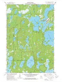
1971 Lac Du Flambeau
Vilas County, WI

1981 Black Oak Lake
Vilas County, WI

1981 Manitowish Lake
Vilas County, WI

1981 Papoose Lake
Vilas County, WI

1981 Phelps
Vilas County, WI

1981 Pioneer Lake
Vilas County, WI

1981 Presque Isle
Vilas County, WI

1981 Tenderfoot Lake
Vilas County, WI

1981 White Sand Lake
Vilas County, WI

1982 Harris Lake
Vilas County, WI

1982 Land O'Lakes
Vilas County, WI

1982 Star Lake
Vilas County, WI

1982 Stormy Lake
Vilas County, WI

1999 Black Oak Lake
Vilas County, WI

1999 Land O'Lakes
Vilas County, WI

1999 Phelps
Vilas County, WI

1999 Presque Isle
Vilas County, WI

1999 Tenderfoot Lake
Vilas County, WI

2005 Lac Du Flambeau
Vilas County, WI