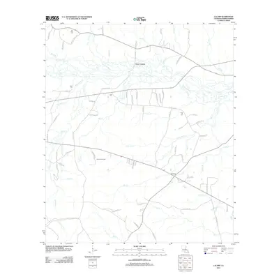
2012 Map of Lacamp
USGS Topo · Published 2012About this map
The Calcasieu River winds through the northern portion of this Vernon Parish landscape, defining a terrain of dense creek networks and rural crossings. Settlement centers on Lacamp and Hicks Crossing, with the surrounding timberlands and fields connected by an intricate web of parish roads. Genealogy researchers will find several family and community landmarks, including Pine Island Cem, Mayo Cem, Scott Cem, and Laurel Hill Cem.
Find a feature on this map
84 named features on this map. Tap any name to fly to it.
Don’t see what you’re looking for? This feature index may not catch every label — zoom into the map to look around manually.
Map Details
Editions of this 2012 Lacamp Map
This is the sole edition of this map. No revisions or reprints were ever made.
Other maps of this area

1937 · Chopin SW
USGS Topo · 1:31,680

1937 · Chopin SE
USGS Topo · 1:31,680

1941 · Slagle
USGS Topo · 1:62,500

1942 · Kisatchie
USGS Topo · 1:62,500

1943 · Leander
USGS Topo · 1:62,500

1943 · Kisatchie
USGS Topo · 1:62,500

1944 · Chopin
USGS Topo · 1:62,500

1944 · Slagle
USGS Topo · 1:62,500

1948 · Chopin
USGS Topo · 1:62,500

1953 · Alexandria
USGS Topo · 1:250,000