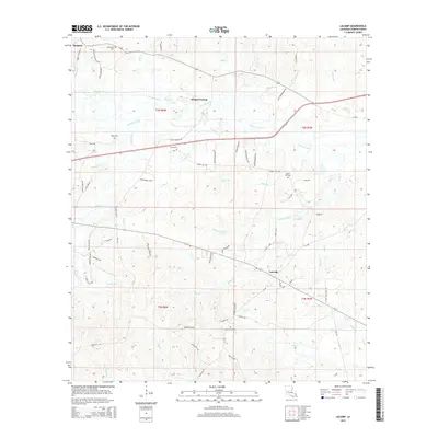
2015 Map of Lacamp
USGS Topo · Published 2015About this map
Simpson and Lacamp anchor this Vernon Parish landscape, where the upper reaches of the Calcasieu River wind through a dense network of timbered creek bottoms and local family roads. The area's rural character is defined by its small community centers and numerous burial grounds, including Pine Island Cem, Mayo Cem, and Scott Cem. Significant local history is embedded in the road names, such as Hicks School Rd and Hicks Fire Tower Rd, which suggest the former locations of essential civic and forestry infrastructure near Hicks Crossing. The topography is dominated by the drainage patterns of N Fork Mill Cr and Evans Br, illustrating the intricate hydrology of the central Louisiana uplands before they give way to the larger river systems to the south.
Find a feature on this map
80 named features on this map. Tap any name to fly to it.
Don’t see what you’re looking for? This feature index may not catch every label — zoom into the map to look around manually.
Map Details
Editions of this 2015 Lacamp Map
This is the sole edition of this map. No revisions or reprints were ever made.
Other maps of this area

1937 · Chopin SW
USGS Topo · 1:31,680

1937 · Chopin SE
USGS Topo · 1:31,680

1941 · Slagle
USGS Topo · 1:62,500

1942 · Kisatchie
USGS Topo · 1:62,500

1943 · Leander
USGS Topo · 1:62,500

1943 · Kisatchie
USGS Topo · 1:62,500

1944 · Chopin
USGS Topo · 1:62,500

1944 · Slagle
USGS Topo · 1:62,500

1948 · Chopin
USGS Topo · 1:62,500

1953 · Alexandria
USGS Topo · 1:250,000