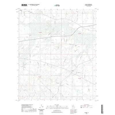
2020 Map of Lacamp
USGS Topo · Published 2020About this map
Simpson and Lacamp anchor this landscape in Vernon Parish, where the winding Calcasieu River and its numerous tributaries like Mims Cr and Yellow Br define the local topography. This region is characterized by a dense network of country roads and family-named landmarks that are vital for genealogical research. Historically significant burial sites, including Pine Island Cem, Mayo Cem, Scott Cem, and Laurel Hill Cem, are scattered throughout the territory, providing fixed points for local heritage. The southern portion of the map transitions into more specialized terrain, marked by Artillery Rd and Fullerton Rd, suggesting the proximity of military or industrial activity. Streams like E Fork Sixmile Cr and N Fork Mill Cr carve through the wooded sections, illustrating the drainage patterns that have long influenced settlement and land use in this part of Louisiana.
Find a feature on this map
80 named features on this map. Tap any name to fly to it.
Don’t see what you’re looking for? This feature index may not catch every label — zoom into the map to look around manually.
Map Details
Editions of this 2020 Lacamp Map
This is the sole edition of this map. No revisions or reprints were ever made.
Other maps of this area

1937 · Chopin SW
USGS Topo · 1:31,680

1937 · Chopin SE
USGS Topo · 1:31,680

1941 · Slagle
USGS Topo · 1:62,500

1942 · Kisatchie
USGS Topo · 1:62,500

1943 · Leander
USGS Topo · 1:62,500

1943 · Kisatchie
USGS Topo · 1:62,500

1944 · Chopin
USGS Topo · 1:62,500

1944 · Slagle
USGS Topo · 1:62,500

1948 · Chopin
USGS Topo · 1:62,500

1953 · Alexandria
USGS Topo · 1:250,000