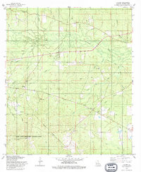
1978 Map of Lacamp
USGS Topo · Published 1979About this map
The Calcasieu River meanders through the heart of this Vernon Parish landscape, which is marked by the encroaching boundaries of the Fort Polk Military Reservation to the south. In the late 1970s, the area retained its rural character with small settlements like Lacamp and Hicks Crossing connected by a network of winding creeks and branches. Evidence of the region’s earlier industrial timber era remains visible through an Old Railroad Grade that cuts through the center of the sheet, tracing a path once used for logging before being reclaimed by the woods.
Find a feature on this map
37 named features on this map. Tap any name to fly to it.
Don’t see what you’re looking for? This feature index may not catch every label — zoom into the map to look around manually.
Map Details
Editions of this 1978 Lacamp Map
This is the sole edition of this map. No revisions or reprints were ever made.
Other maps of this area

1937 · Chopin SW
USGS Topo · 1:31,680

1937 · Chopin SE
USGS Topo · 1:31,680

1941 · Slagle
USGS Topo · 1:62,500

1942 · Kisatchie
USGS Topo · 1:62,500

1943 · Leander
USGS Topo · 1:62,500

1943 · Kisatchie
USGS Topo · 1:62,500

1944 · Chopin
USGS Topo · 1:62,500

1944 · Slagle
USGS Topo · 1:62,500

1948 · Chopin
USGS Topo · 1:62,500

1953 · Alexandria
USGS Topo · 1:250,000