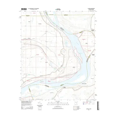
2014 Map of Laconia
USGS Topo · Published 2014About this map
The Mississippi River dominates this landscape along the border of Arkansas and Mississippi, where a complex network of levees and historical crevasses reveals the persistent struggle to manage the river's path. Named features like Knowlton Crevasse, Laconia Crevasse, and Sledge Crevasse indicate past breach points that shaped the local topography and drainage patterns. The settlement of Laconia and the nearby Laconia Circle sit within this alluvial plain, supported by a series of river access points including Dennis Landing, Cessions Landing, and Australia Landing.
Find a feature on this map
56 named features on this map. Tap any name to fly to it.
Don’t see what you’re looking for? This feature index may not catch every label — zoom into the map to look around manually.
Map Details
Editions of this 2014 Laconia Map
This is the sole edition of this map. No revisions or reprints were ever made.
Other maps of this area

1930 · Mellwood
USGS Topo · 1:62,500

1939 · Henrico
USGS Topo · 1:62,500

1939 · Pace
USGS Topo · 1:62,500

1939 · Big Island
USGS Topo · 1:62,500

1939 · Mellwood
USGS Topo · 1:62,500

1948 · Helena
USGS Topo · 1:250,000

1950 · Helena
USGS Topo · 1:250,000

1953 · Greenwood
USGS Topo · 1:250,000

1954 · Mellwood
USGS Topo · 1:62,500

1954 · Henrico
USGS Topo · 1:62,500