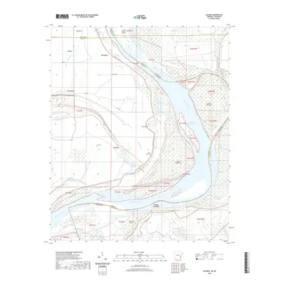
2020 Map of Laconia
USGS Topo · Published 2020About this map
The Mississippi River carves a complex, shifting path through this region, defining the border between Arkansas and Mississippi. Along its western banks, the Arkansas settlements of Laconia and Knowlton sit protected by the Mississippi Levee Rd, a landscape defined by alluvial features like the Knowlton Crevasse and Laconia Crevasse. These crevasse labels mark the historical scars of levee breaks, where floodwaters once carved deep channels into the floodplain.
Find a feature on this map
48 named features on this map. Tap any name to fly to it.
Don’t see what you’re looking for? This feature index may not catch every label — zoom into the map to look around manually.
Map Details
Editions of this 2020 Laconia Map
This is the sole edition of this map. No revisions or reprints were ever made.
Other maps of this area

1930 · Mellwood
USGS Topo · 1:62,500

1939 · Henrico
USGS Topo · 1:62,500

1939 · Pace
USGS Topo · 1:62,500

1939 · Big Island
USGS Topo · 1:62,500

1939 · Mellwood
USGS Topo · 1:62,500

1948 · Helena
USGS Topo · 1:250,000

1950 · Helena
USGS Topo · 1:250,000

1953 · Greenwood
USGS Topo · 1:250,000

1954 · Mellwood
USGS Topo · 1:62,500

1954 · Henrico
USGS Topo · 1:62,500