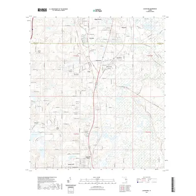
2021 Map of Lacoochee
USGS Topo · Published 2021About this map
Lacoochee and the neighboring settlements of Trilcoochee and Trilby form a corridor of historic growth along the CSX Transportation railroad lines in northern Pasco County. This modern 2021 study documents the region's rural character, where residential clusters like Moss Town and Tommytown sit amid an extensive network of wetlands and water bodies. The Withlacoochee River winds through the eastern portion of the map, flanked by protected areas such as the Withlacoochee State Forest. Significant for local historians, the sheet identifies multiple airfields, including Field of Dreams Airport and Cub Haven Airport, alongside established burial grounds like the Trilby Cem and Indian Pond Cem. The landscape transitions from the developed streets of Dade City and Dade City North into the swampy terrain of Sawgrass Lake and Owensboro Swamp, illustrating the persistent influence of the Florida environment on local settlement patterns.
Find a feature on this map
57 named features on this map. Tap any name to fly to it.
Don’t see what you’re looking for? This feature index may not catch every label — zoom into the map to look around manually.
Map Details
Editions of this 2021 Lacoochee Map
This is the sole edition of this map. No revisions or reprints were ever made.
Other maps of this area

1954 · Spring Lake
USGS Topo · 1:24,000

1954 · San Antonio
USGS Topo · 1:24,000

1954 · Brooksville SE
USGS Topo · 1:24,000

1955 · Plant City
USGS Topo · 1:250,000

1958 · Plant City
USGS Topo · 1:250,000

1958 · Webster
USGS Topo · 1:24,000

1958 · Saint Catherine
USGS Topo · 1:24,000

1959 · Plant City
USGS Topo · 1:250,000

1960 · Lacoochee
USGS Topo · 1:24,000

1960 · Branchborough
USGS Topo · 1:24,000