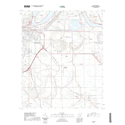
2020 Map of Ladd
USGS Topo · Published 2020About this map
Pine Bluff anchors the northwestern corner of this study, where the urban grid gives way to the low-lying reaches of the Arkansas River and its complex drainage network. The landscape is defined by the winding paths of Bayou Bartholomew, Deep Bayou, and Little Cypress Bayou, reflecting the alluvial character of Jefferson County. Small clusters of settlement like Fairfield, Glenlake, and Ladd are scattered across the flats, often oriented around the historical intersections of local roads and the natural levees of the waterways.
Find a feature on this map
104 named features on this map. Tap any name to fly to it.
Don’t see what you’re looking for? This feature index may not catch every label — zoom into the map to look around manually.
Map Details
Editions of this 2020 Ladd Map
This is the sole edition of this map. No revisions or reprints were ever made.
Other maps of this area

1932 · Pastoria
USGS Topo · 1:62,500

1935 · Altheimer
USGS Topo · 1:62,500

1935 · Pastoria
USGS Topo · 1:62,500

1935 · Noble Lake
USGS Topo · 1:62,500

1948 · Helena
USGS Topo · 1:250,000

1950 · Helena
USGS Topo · 1:250,000

1955 · Helena
USGS Topo · 1:250,000

1955 · Little Rock
USGS Topo · 1:250,000

1956 · Little Rock
USGS Topo · 1:250,000

1959 · Helena
USGS Topo · 1:250,000