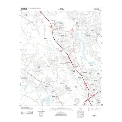
2011 Map of Ladson
USGS Topo · Published 2011About this map
Goose Creek and the Ashley River corridor define the suburban landscape of the South Carolina Lowcountry at the start of the 21st century. This survey documents the significant density of residential developments such as Ladson Village, Windsor Hills, and Otranto as they expanded into formerly rural areas. The campus of Charleston Southern University stands as a central institutional landmark, alongside the massive footprint of the Charleston International Airport and the nearby US Air Force Golf Course. For local historians and genealogists, the map identifies several significant burial grounds including Saint James Goose Creek Cemetery and the Cherry Hill Cemetery. The infrastructure of the area is highlighted by the Goose Creek Reservoir and the Charleston Waterworks, essential to the growth of Hanahan and the surrounding Berkeley and Charleston County neighborhoods.
Find a feature on this map
193 named features on this map. Tap any name to fly to it.
Don’t see what you’re looking for? This feature index may not catch every label — zoom into the map to look around manually.
Map Details
Editions of this 2011 Ladson Map
This is the sole edition of this map. No revisions or reprints were ever made.
Other maps of this area

1919 · Ladson
USGS Topo · 1:21,120

1919 · Johns Island
USGS Topo · 1:21,120

1919 · Summerville
USGS Topo · 1:48,000

1919 · Cordesville
USGS Topo · 1:48,000

1919 · Melgrove
USGS Topo · 1:21,120

1919 · Charleston
USGS Topo · 1:21,120

1920 · Ravenels
USGS Topo · 1:62,500

1920 · Summerville
USGS Topo · 1:62,500

1940 · Melgrove
USGS Topo · 1:24,000

1943 · Ladson
USGS Topo · 1:24,000