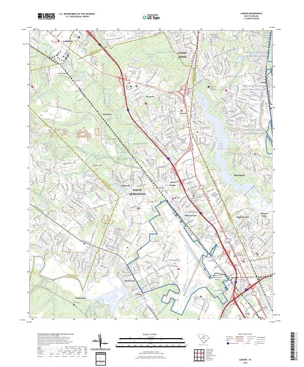
2024 Map of Ladson
USGS Topo · Published 2024About this map
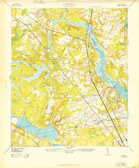
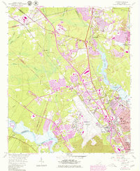
North Charleston and Goose Creek anchor this survey of the South Carolina Lowcountry, where the convergence of major infrastructure and historic landmarks defines the modern landscape. The map details a heavy military and transportation presence, dominated by the Charleston Air Force Base/International Airport and the sprawling Joint Base Charleston Naval Weapons Station to the east. These federal installations sit alongside academic centers like Charleston Southern University and specialized residential communities including Hunley Park and Otranto.
Find a feature on this map
399 named features on this map. Tap any name to fly to it.
Don’t see what you’re looking for? This feature index may not catch every label — zoom into the map to look around manually.
Map Details
Editions of this 2024 Ladson Map
This is the sole edition of this map. No revisions or reprints were ever made.
Historical Maps of Ararat Through Time
4 maps found