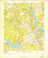
1943 Map of Ladson
USGS Topo · Published 1943About this map
Magnolia Gardens and the Ashley River corridor define the southern reach of this 1943 survey, capturing the Lowcountry landscape during a period of mobilization. The map illustrates a critical infrastructure hub where the Southern and Atlantic Coast Line railroads converge near the Charleston Military Airport and the Charleston Waterworks at Goose Creek.
Find a feature on this map
35 named features on this map. Tap any name to fly to it.
Don’t see what you’re looking for? This feature index may not catch every label — zoom into the map to look around manually.
Map Details
Editions of this 1943 Ladson Map
2 editions found
Other maps of this area

1919 · Ladson
USGS Topo · 1:21,120

1919 · Johns Island
USGS Topo · 1:21,120

1919 · Summerville
USGS Topo · 1:48,000

1919 · Cordesville
USGS Topo · 1:48,000

1919 · Melgrove
USGS Topo · 1:21,120

1919 · Charleston
USGS Topo · 1:21,120

1920 · Ravenels
USGS Topo · 1:62,500

1920 · Summerville
USGS Topo · 1:62,500

1940 · Melgrove
USGS Topo · 1:24,000

1943 · Ladson
USGS Topo · 1:24,000