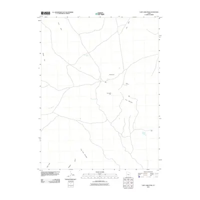
2010 Map of Lady Laird Peak
USGS Topo · Published 2010About this map
Joy stands as the central point of interest in this high-desert mining district, situated between the Drum Mountains and the Wildcat Hills. The map documents a landscape defined by industrial history and natural water sources, featuring several named mining operations that draw from the local mineral wealth. Significant peaks such as Mount Laird and Lady Laird Peak dominate the topography, providing a geographic anchor for the various canyons and valleys that cut through the region.
Find a feature on this map
16 named features on this map. Tap any name to fly to it.
Don’t see what you’re looking for? This feature index may not catch every label — zoom into the map to look around manually.
Map Details
Editions of this 2010 Lady Laird Peak Map
This is the sole edition of this map. No revisions or reprints were ever made.
Other maps of this area

1885 · Sevier Desert
USGS Topo · 1:250,000

1908 · Fish Springs
USGS Topo · 1:250,000

1910 · Fish Springs
USGS Topo · 1:250,000

1953 · Topaz Mtn
USGS Topo · 1:62,500

1953 · Delta
USGS Topo · 1:250,000

1958 · Delta
USGS Topo · 1:250,000

1962 · Delta
USGS Topo · 1:250,000

1971 · Picture Rock Hills
USGS Topo · 1:24,000

1971 · Drum Mts Well
USGS Topo · 1:24,000
1971 · Smelter Knolls West
USGS Topo · 1:24,000