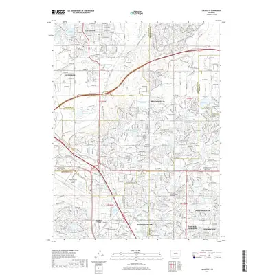
2019 Map of Lafayette
USGS Topo · Published 2019About this map
The suburban development and complex water management systems of the northern Denver metropolitan area are documented here, where the boundaries of Boulder, Broomfield, Adams, and Jefferson counties converge. Large municipalities including Lafayette, Louisville, and Broomfield are shown in a state of dense expansion, characterized by a sophisticated network of recreational paths like the Coal Creek Trail and Rock Creek Trail. The landscape is defined by its engineering history, featuring an extensive array of reservoirs and ditches such as Waneka Reservoir, Le Gault Reservoir, and the Highline Canal. Higher education and civic centers are prominent, including the Regis University Broomfield Campus and the Broomfield County Courthouse. This map reveals how historical water infrastructure, originally built for agriculture, has been integrated into modern urban planning through numerous greenways and community landmarks like Wallace Village and the Louisville Cemetery.
Find a feature on this map
64 named features on this map. Tap any name to fly to it.
Don’t see what you’re looking for? This feature index may not catch every label — zoom into the map to look around manually.
Map Details
Editions of this 2019 Lafayette Map
This is the sole edition of this map. No revisions or reprints were ever made.
Other maps of this area

1890 · East Denver
USGS Topo · 1:125,000

1899 · West Denver
USGS Topo · 1:125,000

1902 · Greeley
USGS Topo · 1:125,000

1904 · Niwot
USGS Topo · 1:62,500

1938 · Derby
USGS Topo · 1:24,000

1939 · Golden
USGS Topo · 1:24,000

1940 · Eastlake
USGS Topo · 1:31,680

1940 · Lafayette
USGS Topo · 1:31,680

1940 · Derby
USGS Topo · 1:31,680

1941 · Arvada
USGS Topo · 1:31,680