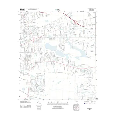
2012 Map of Lafayette
USGS Topo · Published 2012About this map
Lafayette and its surrounding Leon County settlements are captured here during a period of suburban expansion east of the state capital. The map showcases a landscape defined by significant water bodies, most notably the expansive Lake Lafayette and Buck Lake, which are interconnected by a complex network of smaller basins like J R Alford Pond and Headley Pond. The presence of the Soda Field Cem provides a point of interest for genealogists tracing local family roots in the areas of Saint Peter and Perkins. The transportation infrastructure is well-defined, showing the modern path of Interstate 10 alongside older thoroughfares such as Old Saint Augustine Rd. This map illustrates how the residential growth of Gardner and neighboring communities has been shaped by the natural drainage of Shepherd Br and the local pond systems.
Find a feature on this map
21 named features on this map. Tap any name to fly to it.
Don’t see what you’re looking for? This feature index may not catch every label — zoom into the map to look around manually.
Map Details
Editions of this 2012 Lafayette Map
This is the sole edition of this map. No revisions or reprints were ever made.
Other maps of this area

1940 · Tallahassee
USGS Topo · 1:62,500

1942 · Tallahassee
USGS Topo · 1:62,500

1943 · Tallahassee
USGS Topo · 1:62,500

1954 · Lloyd
USGS Topo · 1:24,000

1954 · Lafayette
USGS Topo · 1:24,000

1954 · Cody
USGS Topo · 1:24,000

1954 · Woodville
USGS Topo · 1:24,000

1954 · Tallahassee
USGS Topo · 1:250,000

1959 · Tallahassee
USGS Topo · 1:250,000

1960 · Tallahassee
USGS Topo · 1:250,000