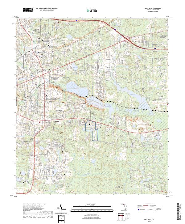
2024 Map of Lafayette
USGS Topo · Published 2024About this map
Tallahassee National Cemetery and the complex lacustrine system of the Lafayette area define this landscape east of the Florida state capital. The map reveals a dense concentration of burial grounds and religious sites, including the Southwood Plantation Cem and the Connie Copeland African-American Cem, reflecting the deep ancestral and social layers of Leon County. The hydrology is centered on the interconnected basins of Upper Lake Lafayette, Piney Z Lake, and Lower Lake Lafayette, which are preserved through the Lafayette Heritage Trail Park and Tom Brown Park. Historical transit corridors like Old Saint Augustine Rd and Miccosukee Rd provide the framework for suburban growth around settlements such as Saint Peter and Perkins. The presence of the Verdura Plantation Cem and the Shady Grove Primitive Baptist Church Cem No 1 highlights the area's transition from an antebellum agricultural landscape to a modern residential and recreational hub.
Find a feature on this map
60 named features on this map. Tap any name to fly to it.
Don’t see what you’re looking for? This feature index may not catch every label — zoom into the map to look around manually.
Map Details
Editions of this 2024 Lafayette Map
This is the sole edition of this map. No revisions or reprints were ever made.
Other maps of this area

1940 · Tallahassee
USGS Topo · 1:62,500

1942 · Tallahassee
USGS Topo · 1:62,500

1943 · Tallahassee
USGS Topo · 1:62,500

1954 · Lloyd
USGS Topo · 1:24,000

1954 · Lafayette
USGS Topo · 1:24,000

1954 · Cody
USGS Topo · 1:24,000

1954 · Woodville
USGS Topo · 1:24,000

1954 · Tallahassee
USGS Topo · 1:250,000

1959 · Tallahassee
USGS Topo · 1:250,000

1960 · Tallahassee
USGS Topo · 1:250,000