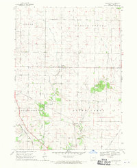
1968 Map of Lafayette
USGS Topo · Published 1970About this map
The small unincorporated community of Lafayette serves as the central focal point of this 1968 Linn County survey, positioned near the confluence of local tributaries. The landscape is defined by the winding paths of West Otter Creek and East Otter Creek, which divide the townships of Grant, Spring Grove, Washington, and Otter Creek. The rural character of the era is evidenced by a high density of local burial grounds and religious sites, including West Prairie Cem, Oliphant Cem, and Salem Ch.
Find a feature on this map
19 named features on this map. Tap any name to fly to it.
Don’t see what you’re looking for? This feature index may not catch every label — zoom into the map to look around manually.
Map Details
Editions of this 1968 Lafayette Map
2 editions found
Other maps of this area

1888 · Shellsburg
USGS Topo · 1:62,500

1888 · Marion
USGS Topo · 1:62,500

1889 · Marion
USGS Topo · 1:62,500

1889 · Shellsburg
USGS Topo · 1:62,500

1899 · Shellsburg
USGS Topo · 1:62,500

1903 · Winthrop
USGS Topo · 1:125,000

1959 · Dubuque
USGS Topo · 1:250,000

1961 · Dubuque
USGS Topo · 1:250,000

1962 · Dubuque
USGS Topo · 1:250,000
1967 · Cedar Rapids North
USGS Topo · 1:24,000