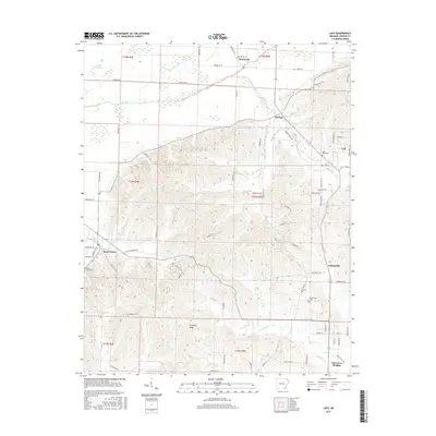
2017 Map of Lafe
USGS Topo · Published 2017About this map
Crowleys Ridge rises above the alluvial plains of Greene County, providing a distinct topographic break that has historically influenced the settlement patterns of northeast Arkansas. This 2017 survey shows the ridge-top and valley communities of Lafe, Gainesville, and Oak Grove Heights, where the elevation change creates a complex drainage system including Scatter Cr and Locust Cr. The lowland areas to the west are dominated by the Cache River and an intricate network of engineered waterways such as Lateral Number 13 and Lateral Number 1, reflecting the area's agricultural reclamation. Local genealogists will find several burial sites well-documented, including Saint Johns Cem near Lafe and the Beech Grove Cem to the southwest. The map preserves the modern rural road grid, from Brownie Rd to the winding Waller Circle Rd, illustrating the intersection of natural landforms and human development.
Find a feature on this map
80 named features on this map. Tap any name to fly to it.
Don’t see what you’re looking for? This feature index may not catch every label — zoom into the map to look around manually.
Map Details
Editions of this 2017 Lafe Map
This is the sole edition of this map. No revisions or reprints were ever made.
Other maps of this area

1935 · Rector
USGS Topo · 1:62,500

1935 · Knobel
USGS Topo · 1:62,500

1940 · Gainesville
USGS Topo · 1:62,500

1940 · Marmaduke
USGS Topo · 1:62,500

1941 · Knobel
USGS Topo · 1:62,500

1957 · Poplar Bluff
USGS Topo · 1:250,000

1958 · Marmaduke
USGS Topo · 1:62,500

1958 · Gainesville
USGS Topo · 1:62,500

1958 · Rector
USGS Topo · 1:62,500

1959 · Poplar Bluff
USGS Topo · 1:250,000