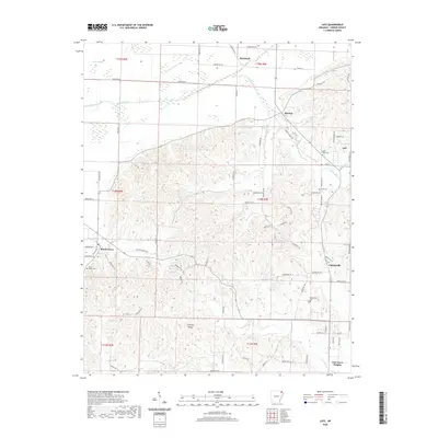
2020 Map of Lafe
USGS Topo · Published 2020About this map
Crowleys Ridge dominates the central topography of this Greene County landscape, rising distinctly above the flatter drainage basins of the Cache River and Big Cr. The elevation profile here creates a sharp contrast between the upland terrain and the engineered drainage systems to the north and east, where Lateral Number 13 and Lateral Number 1 support the region's agricultural layout. Small rural communities like Lafe and Gainesville serve as local hubs, connected by a network of named county roads that follow both the section lines and the natural contours of the ridge. For those tracing family history, several burial sites are documented including Lafe Cem, Saint Johns Cem, and the Beech Grove Cem near the settlement of Beech Grove. The transition from the alluvial bottomlands to the wooded slopes of the ridge defines the land use throughout this portion of Northeast Arkansas.
Find a feature on this map
82 named features on this map. Tap any name to fly to it.
Don’t see what you’re looking for? This feature index may not catch every label — zoom into the map to look around manually.
Map Details
Editions of this 2020 Lafe Map
This is the sole edition of this map. No revisions or reprints were ever made.
Other maps of this area

1935 · Rector
USGS Topo · 1:62,500

1935 · Knobel
USGS Topo · 1:62,500

1940 · Gainesville
USGS Topo · 1:62,500

1940 · Marmaduke
USGS Topo · 1:62,500

1941 · Knobel
USGS Topo · 1:62,500

1957 · Poplar Bluff
USGS Topo · 1:250,000

1958 · Marmaduke
USGS Topo · 1:62,500

1958 · Gainesville
USGS Topo · 1:62,500

1958 · Rector
USGS Topo · 1:62,500

1959 · Poplar Bluff
USGS Topo · 1:250,000