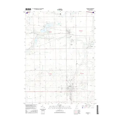
2016 Map of Lagrange
USGS Topo · Published 2016About this map
The town of Lagrange serves as the focal point of this northeastern Indiana landscape, where a sophisticated network of drainage ditches and natural waterways supports a heritage of milling and agriculture. The Pigeon River and Fawn River cross the northern reaches, feeding the Ontario Millpond and historic sites like Star Mill. These watercourses are supplemented by an extensive system of human-engineered channels, including Rowe Ditch, McManus Ditch, and Stoner Ditch, illustrating the intensive efforts to manage the wetlands common to this region. Near the settlement of Howe, several cemeteries such as Oaklawn Cem and Riverside Cem provide valuable touchpoints for genealogical research. The map also documents the transition from traditional commerce to modern transit, featuring the Reid-Eash Airport and Yoder Field alongside established village centers.
Find a feature on this map
77 named features on this map. Tap any name to fly to it.
Don’t see what you’re looking for? This feature index may not catch every label — zoom into the map to look around manually.
Map Details
Editions of this 2016 Lagrange Map
This is the sole edition of this map. No revisions or reprints were ever made.
Other maps of this area

1914 · Three Rivers
USGS Topo · 1:62,500

1916 · Three Rivers
USGS Topo · 1:62,500

1943 · Three Rivers
USGS Topo · 1:62,500

1947 · Mongo
USGS Topo · 1:24,000

1947 · Lagrange
USGS Topo · 1:24,000

1947 · Wolcottville
USGS Topo · 1:24,000

1947 · Oliver Lake
USGS Topo · 1:24,000

1953 · Fort Wayne
USGS Topo · 1:250,000

1956 · Fort Wayne
USGS Topo · 1:250,000

1959 · Wolcottville
USGS Topo · 1:24,000