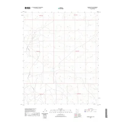
2020 Map of Laguna Castillo
USGS Topo · Published 2020About this map
Laguna Castillo sits as a central water feature in this high-desert expanse of McKinley County, within the Eastern Navajo Agency. The terrain is defined by a series of mesas and drainages, where the sparse network of thoroughfares like Indian Svc Rte 481 and Heartbutte Rd provides the primary access through the undulating landscape. The northern section of the map reveals a complex topography of ridges and draws, while the southern reaches are crossed by White Ridge Rd near the borders of various township divisions. This map illustrates the intersection of traditional land use and modern infrastructure in a region where water sources and topographic high points have historically guided movement and settlement patterns.
Find a feature on this map
10 named features on this map. Tap any name to fly to it.
Don’t see what you’re looking for? This feature index may not catch every label — zoom into the map to look around manually.
Map Details
Editions of this 2020 Laguna Castillo Map
This is the sole edition of this map. No revisions or reprints were ever made.
Other maps of this area

1883 · Mt. Taylor
USGS Topo · 1:250,000

1886 · Wingate
USGS Topo · 1:250,000

1886 · Mt. Taylor
USGS Topo · 1:250,000

1892 · Wingate
USGS Topo · 1:250,000

1892 · Mt. Taylor
USGS Topo · 1:250,000

1899 · Mt. Taylor
USGS Topo · 1:250,000

1954 · Gallup
USGS Topo · 1:250,000

1958 · Gallup
USGS Topo · 1:250,000

1958 · Albuquerque
USGS Topo · 1:250,000

1959 · Gallup
USGS Topo · 1:250,000