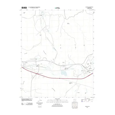
2010 Map of Laguna
USGS Topo · Published 2010About this map
Laguna and its neighboring settlements form a cultural and geographic corridor along the Rio San Jose in the early 21st century. The map documents the intricate network of tribal infrastructure, including numerous Indian Service Routes that connect Encinal in the north to the larger communities of Paraje, Casa Blanca, and New Laguna. This 2010 survey highlights the importance of water management in this arid landscape through the presence of the Paraje Irrigation Ditch and Casa Blanca Ditch. Genealogists will find several burial grounds noted, such as the Paraje Cemetery, Eckerman Cemetery, and San Jose Cemetery. The terrain is defined by dramatic geological features like The Indian Peaks, Seama Mesa, and Frog Mesa, while industrial land use is evidenced by the Bentonite Deposit and the Transwestern Pipeline Number 6 Airport.
Find a feature on this map
51 named features on this map. Tap any name to fly to it.
Don’t see what you’re looking for? This feature index may not catch every label — zoom into the map to look around manually.
Map Details
Editions of this 2010 Laguna Map
This is the sole edition of this map. No revisions or reprints were ever made.
Other maps of this area

1883 · Mt. Taylor
USGS Topo · 1:250,000

1886 · Mt. Taylor
USGS Topo · 1:250,000

1892 · Mt. Taylor
USGS Topo · 1:250,000

1899 · Mt. Taylor
USGS Topo · 1:250,000

1917 · Cerro Verde
USGS Topo · 1:125,000

1917 · Broom Mountain
USGS Topo · 1:125,000

1954 · Socorro
USGS Topo · 1:250,000

1957 · Mount Taylor
USGS Topo · 1:24,000

1957 · Laguna
USGS Topo · 1:24,000

1957 · Moquino
USGS Topo · 1:24,000