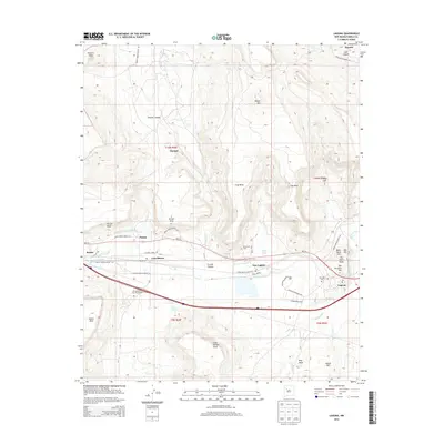
2013 Map of Laguna
USGS Topo · Published 2013About this map
Laguna and the surrounding Laguna Pueblo lands are centered around the vital Rio San Jose corridor in this 2013 survey. The mapping details several distinct settlements, including Paguate to the north and the clustered communities of New Laguna, Casa Blanca, and Paraje. This area is defined by its deep canyons and prominent mesas, such as Frog Mesa and Seama Mesa, which influence the local infrastructure and irrigation patterns. The Paraje Irrigation Ditch and Casa Blanca Ditch illustrate the ongoing relationship between the landscape and local agriculture. Genealogists and local historians can locate several burial grounds, including the San Jose Cem and Eckerman Cem, while the inclusion of the 107 Acoma/Sky City Interchange and multiple Indian Service Routes shows the modernization of transportation through these ancestral lands.
Find a feature on this map
55 named features on this map. Tap any name to fly to it.
Don’t see what you’re looking for? This feature index may not catch every label — zoom into the map to look around manually.
Map Details
Editions of this 2013 Laguna Map
This is the sole edition of this map. No revisions or reprints were ever made.
Other maps of this area

1883 · Mt. Taylor
USGS Topo · 1:250,000

1886 · Mt. Taylor
USGS Topo · 1:250,000

1892 · Mt. Taylor
USGS Topo · 1:250,000

1899 · Mt. Taylor
USGS Topo · 1:250,000

1917 · Cerro Verde
USGS Topo · 1:125,000

1917 · Broom Mountain
USGS Topo · 1:125,000

1954 · Socorro
USGS Topo · 1:250,000

1957 · Mount Taylor
USGS Topo · 1:24,000

1957 · Laguna
USGS Topo · 1:24,000

1957 · Moquino
USGS Topo · 1:24,000