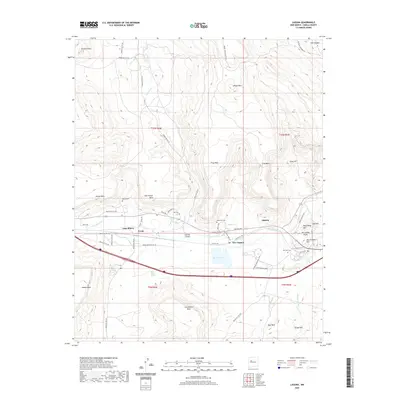
2020 Map of Laguna
USGS Topo · Published 2020About this map
The Rio San Jose winds through a high-desert landscape defined by mesas and established Pueblo settlements in this 2020 topographic record. The central corridor is anchored by Laguna, New Laguna, Paraje, and Casa Blanca, reflecting a clustered habitation pattern tied to the valley floor and modern transit routes. This area is characterized by significant topographic relief, where features like Paraje Mesa and Casa Blanca Mesa rise abruptly from the surrounding plains.
Find a feature on this map
62 named features on this map. Tap any name to fly to it.
Don’t see what you’re looking for? This feature index may not catch every label — zoom into the map to look around manually.
Map Details
Editions of this 2020 Laguna Map
This is the sole edition of this map. No revisions or reprints were ever made.
Other maps of this area

1883 · Mt. Taylor
USGS Topo · 1:250,000

1886 · Mt. Taylor
USGS Topo · 1:250,000

1892 · Mt. Taylor
USGS Topo · 1:250,000

1899 · Mt. Taylor
USGS Topo · 1:250,000

1917 · Cerro Verde
USGS Topo · 1:125,000

1917 · Broom Mountain
USGS Topo · 1:125,000

1954 · Socorro
USGS Topo · 1:250,000

1957 · Mount Taylor
USGS Topo · 1:24,000

1957 · Laguna
USGS Topo · 1:24,000

1957 · Moquino
USGS Topo · 1:24,000