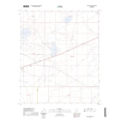
2023 Map of Laguna Gatuna
USGS Topo · Published 2023About this map
The arid plains of the New Mexico borderlands define this landscape, where the Eddy and Lea County line divides a terrain marked by distinctive saline depressions. These geological features, including the central Laguna Gatuna, Laguna Plata to the northwest, and Laguna Tonto to the north, reflect the unique hydrology of the Permian Basin. The small settlement of Halfway serves as a crossroads in the southwestern portion of the map, anchored by the intersection of regional highways and local routes like Recovery Ln.
Find a feature on this map
19 named features on this map. Tap any name to fly to it.
Don’t see what you’re looking for? This feature index may not catch every label — zoom into the map to look around manually.
Map Details
Editions of this 2023 Laguna Gatuna Map
This is the sole edition of this map. No revisions or reprints were ever made.
Other maps of this area

1939 · Nash Draw
USGS Topo · 1:62,500

1942 · Clayton Basin
USGS Topo · 1:62,500

1943 · Clayton Basin
USGS Topo · 1:62,500

1943 · Nash Draw
USGS Topo · 1:62,500

1954 · Hobbs
USGS Topo · 1:250,000

1958 · Hobbs
USGS Topo · 1:250,000

1963 · Laguna Gatuna
USGS Topo · 1:62,500

1963 · Hat Mesa
USGS Topo · 1:62,500

1978 · Jal
USGS Topo · 1:100,000

1984 · Lea
USGS Topo · 1:24,000