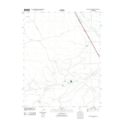
2012 Map of Laguna Seca Ranch
USGS Topo · Published 2012About this map
Governor Edmund G Brown California Aqueduct cuts a bold diagonal across this landscape, illustrating the massive water infrastructure required to sustain the arid agricultural regions of Fresno County. The terrain is defined by dry canyons and intermittent watercourses, including Wildcat Canyon and Salt Canyon, which drain toward the Little Panoche Valley. Agriculture and ranching dominate the human footprint, anchored by the Laguna Seca Ranch in the northwest and Barneich Ranch near the southern boundary. At the heart of the drainage system lies the Little Panoche Reservoir, a critical collection point for the waters of Little Panoche Cr. A network of rural routes such as Paul Negra Rd and Avery Rd provides access to these isolated ranching operations, tracing the contours of a landscape managed for resource extraction and livestock in the early 21st century.
Find a feature on this map
18 named features on this map. Tap any name to fly to it.
Don’t see what you’re looking for? This feature index may not catch every label — zoom into the map to look around manually.
Map Details
Editions of this 2012 Laguna Seca Ranch Map
This is the sole edition of this map. No revisions or reprints were ever made.
Other maps of this area

1913 · Panoche
USGS Topo · 1:125,000

1920 · Carrisalito Spring
USGS Topo · 1:31,680

1921 · Laguna Seca Ranch
USGS Topo · 1:31,680

1921 · Tierra Loma School
USGS Topo · 1:31,680

1922 · Charleston School
USGS Topo · 1:31,680

1922 · Dos Palos
USGS Topo · 1:31,680

1922 · Ortigalita
USGS Topo · 1:31,680

1923 · Laguna Seca Ranch
USGS Topo · 1:31,680

1923 · Tierra Loma School
USGS Topo · 1:31,680

1923 · Little Panoche
USGS Topo · 1:31,680