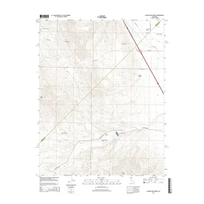
2015 Map of Laguna Seca Ranch
USGS Topo · Published 2015About this map
The Governor Edmund G Brown California Aqueduct cuts a sharp diagonal across this arid landscape where the eastern slopes of the Diablo Range meet the flat floor of the San Joaquin Valley. This 2015 survey illustrates the contrast between the high, folded terrain of the Panoche Hills and the managed water infrastructure critical to the region's agricultural character. Named features like Laguna Seca Ranch and the Little Panoche Valley sit near the base of these hills, marking a boundary between the wilder Wildcat Canyon and the developed Central Valley. Water management is central to the area's geography, evidenced by the Little Panoche Reservoir and the drainage of Little Panoche Cr and Laguna Seca Cr. A network of local roads including Little Panoche Rd and Paul Negra Rd provide access through the canyons and along the foothills.
Find a feature on this map
26 named features on this map. Tap any name to fly to it.
Don’t see what you’re looking for? This feature index may not catch every label — zoom into the map to look around manually.
Map Details
Editions of this 2015 Laguna Seca Ranch Map
This is the sole edition of this map. No revisions or reprints were ever made.
Other maps of this area

1913 · Panoche
USGS Topo · 1:125,000

1920 · Carrisalito Spring
USGS Topo · 1:31,680

1921 · Laguna Seca Ranch
USGS Topo · 1:31,680

1921 · Tierra Loma School
USGS Topo · 1:31,680

1922 · Charleston School
USGS Topo · 1:31,680

1922 · Dos Palos
USGS Topo · 1:31,680

1922 · Ortigalita
USGS Topo · 1:31,680

1923 · Laguna Seca Ranch
USGS Topo · 1:31,680

1923 · Tierra Loma School
USGS Topo · 1:31,680

1923 · Little Panoche
USGS Topo · 1:31,680