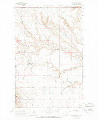
1964 Map of Laird School
USGS Topo · Published 1966About this map
The international border between Alberta and Montana defines the northern edge of this northern Liberty County landscape, where the Canadian boundary line meets the high plains. The terrain is deeply incised by a series of drainage systems, most notably Sage Creek and Laird Creek, which have carved intricate coulees into the prairie. Local settlement is concentrated in small ranching operations and communal enclaves, including the Sage Creek Colony and the Laird community. Education in this remote ranching district was supported by localized facilities like the Laird School and Osler School, while the southern portion of the map transitions into the industrial geography of the Keith Gas Field. Near the western edge, the distinct landform known as Bears Den stands out among the complex topography of Coal Coulee and Carvers Coulee.
Find a feature on this map
19 named features on this map. Tap any name to fly to it.
Don’t see what you’re looking for? This feature index may not catch every label — zoom into the map to look around manually.
Map Details
Editions of this 1964 Laird School Map
This is the sole edition of this map. No revisions or reprints were ever made.
Other maps of this area

1919 · Alma
USGS Topo · 1:125,000

1954 · Shelby
USGS Topo · 1:250,000

1958 · Shelby
USGS Topo · 1:250,000
1962 · Bingham Lake
USGS Topo · 1:24,000

1962 · Mount Lebanon
USGS Topo · 1:24,000

1963 · Bobcat Coulee SE
USGS Topo · 1:24,000

1963 · Vaver Reservoir
USGS Topo · 1:24,000
1964 · Bobcat Coulee NE
USGS Topo · 1:24,000
1984 · Chester
USGS Topo · 1:100,000

1984 · Sweet Grass Hills
USGS Topo · 1:100,000