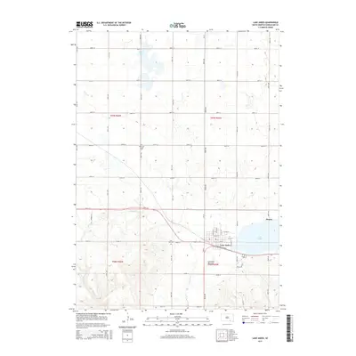
2015 Map of Lake Andes
USGS Topo · Published 2015About this map
Lake Andes serves as the focal point of this Charles Mix County landscape, where the settlement of the same name sits on its western shore. The town's grid is clearly defined by landmarks such as Church St, School St, and S Park Ave, situated near the Abandoned Railroad corridor that once served the region. Outside the primary township, the map documents the rural distribution of the area, including the small settlement of Dezera and the northern waters of Goose Lake.
Find a feature on this map
41 named features on this map. Tap any name to fly to it.
Don’t see what you’re looking for? This feature index may not catch every label — zoom into the map to look around manually.
Map Details
Editions of this 2015 Lake Andes Map
This is the sole edition of this map. No revisions or reprints were ever made.
Other maps of this area

1955 · Mitchell
USGS Topo · 1:250,000

1959 · Mitchell
USGS Topo · 1:250,000

1964 · Ravinia
USGS Topo · 1:24,000

1964 · Lake Andes NW
USGS Topo · 1:24,000

1964 · Fort Randall Dam
USGS Topo · 1:24,000

1964 · Lake Andes SW
USGS Topo · 1:24,000

1964 · Lake Andes
USGS Topo · 1:24,000

1964 · Wagner SW
USGS Topo · 1:24,000
1977 · Wagner SW
USGS Topo · 1:24,000

1977 · Lake Andes NW
USGS Topo · 1:24,000