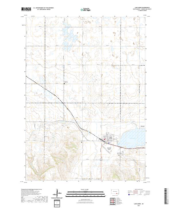
2021 Map of Lake Andes
USGS Topo · Published 2021About this map
The Lake Andes townsite serves as the center of activity on this prairie landscape, where the Charles Mix County Courthouse anchors the local government. To the east of the primary settlement, the lake itself dominates the hydrology of the region, flanked by smaller communities like Dezera. The grid of section lines and gravel roads, such as Co Rd 42 and 291st St, illustrates the organized agricultural expansion of the South Dakota plains. For those tracing family histories, several burial sites are documented across the township, including the West Lake Andes Cem to the northwest and the Saint Philip Deacon Cem near the southern shoreline. Drainage across the rolling terrain is marked by seasonal waterways like Garden Cr and White Swan Cr, while the Goose Lake basin to the north highlights the pothole geography characteristic of the region.
Find a feature on this map
30 named features on this map. Tap any name to fly to it.
Don’t see what you’re looking for? This feature index may not catch every label — zoom into the map to look around manually.
Map Details
Editions of this 2021 Lake Andes Map
This is the sole edition of this map. No revisions or reprints were ever made.
Other maps of this area

1955 · Mitchell
USGS Topo · 1:250,000

1959 · Mitchell
USGS Topo · 1:250,000

1964 · Ravinia
USGS Topo · 1:24,000

1964 · Lake Andes NW
USGS Topo · 1:24,000

1964 · Fort Randall Dam
USGS Topo · 1:24,000

1964 · Lake Andes SW
USGS Topo · 1:24,000

1964 · Lake Andes
USGS Topo · 1:24,000

1964 · Wagner SW
USGS Topo · 1:24,000
1977 · Wagner SW
USGS Topo · 1:24,000

1977 · Lake Andes NW
USGS Topo · 1:24,000