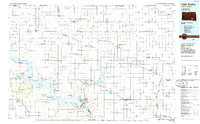
1986 Map of Lake Andes
USGS Topo · Published 1986About this map
The Yankton Indian Reservation dominates the southeastern quadrant of this mid-1980s landscape, illustrating the complex intersection of tribal lands and established prairie townships. The Missouri River forms the primary geographical boundary to the southwest, expanded into the massive Lake Francis Case behind the dam at Fort Randall. This engineering project fundamentally altered the river's original character, creating recreational and wildlife zones like the Karl E Mundt National Wildlife Refuge.
Find a feature on this map
124 named features on this map. Tap any name to fly to it.
Don’t see what you’re looking for? This feature index may not catch every label — zoom into the map to look around manually.
Map Details
Editions of this 1986 Lake Andes Map
3 editions found
Other maps of this area

1898 · Olivet
USGS Topo · 1:125,000

1899 · Mitchell
USGS Topo · 1:125,000

1899 · Alexandria
USGS Topo · 1:125,000

1951 · Butte NW
USGS Topo · 1:24,000

1951 · Naper
USGS Topo · 1:24,000

1955 · Sioux City
USGS Topo · 1:250,000

1955 · Sioux Falls
USGS Topo · 1:250,000

1955 · Mitchell
USGS Topo · 1:250,000

1955 · O'Neill
USGS Topo · 1:250,000

1957 · Ethan
USGS Topo · 1:24,000