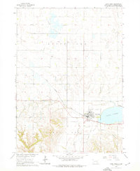
1964 Map of Lake Andes
USGS Topo · Published 1976About this map
Lake Andes dominates this mid-1960s landscape, serving as the focal point for the surrounding community of the same name. The area is characterized by a mix of established civic infrastructure and early-century remnants, including the Chicago Milwaukee St Paul and railway line and an Old Railroad Grade further south. The map documents a transition in local transportation and entertainment, featuring the Lake Andes Airport and a Drive-in Theater near the town center.
Find a feature on this map
23 named features on this map. Tap any name to fly to it.
Don’t see what you’re looking for? This feature index may not catch every label — zoom into the map to look around manually.
Map Details
Editions of this 1964 Lake Andes Map
2 editions found
Other maps of this area

1955 · Mitchell
USGS Topo · 1:250,000

1959 · Mitchell
USGS Topo · 1:250,000

1964 · Ravinia
USGS Topo · 1:24,000

1964 · Lake Andes NW
USGS Topo · 1:24,000

1964 · Fort Randall Dam
USGS Topo · 1:24,000

1964 · Lake Andes SW
USGS Topo · 1:24,000

1964 · Lake Andes
USGS Topo · 1:24,000

1964 · Wagner SW
USGS Topo · 1:24,000

1977 · Wagner SW
USGS Topo · 1:24,000

1977 · Lake Andes NW
USGS Topo · 1:24,000