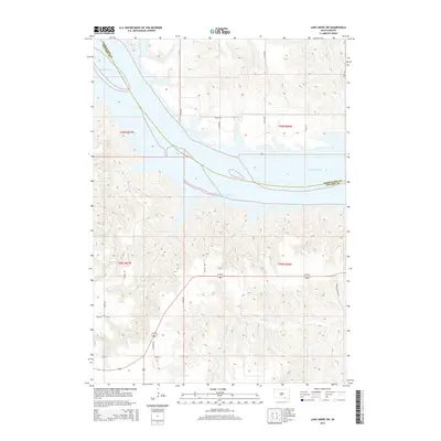
2015 Map of Lake Andes SW
USGS Topo · Published 2015About this map
Lake Francis Case dominates the central landscape of this South Dakota survey, illustrating the significant reach of the Missouri River as it defines the boundary between Charles Mix and Gregory counties. This section of the river system is characterized by intricate drainage patterns from smaller tributaries like Joe Days Cr and Randall Cr, which cut through the surrounding uplands. The road network, including Joe Day Rd and Randall Valley Rd, reflects the rural development and land management patterns of the mid-2010s. The map provides a clear record of the area's hydrology and topography, capturing the relationship between the managed waters of the reservoir and the agricultural plains of White Swan Township.
Find a feature on this map
22 named features on this map. Tap any name to fly to it.
Don’t see what you’re looking for? This feature index may not catch every label — zoom into the map to look around manually.
Map Details
Editions of this 2015 Lake Andes SW Map
This is the sole edition of this map. No revisions or reprints were ever made.
Other maps of this area

1955 · Mitchell
USGS Topo · 1:250,000

1955 · O'Neill
USGS Topo · 1:250,000

1959 · O'Neill
USGS Topo · 1:250,000

1959 · Mitchell
USGS Topo · 1:250,000

1964 · Campbell Creek
USGS Topo · 1:24,000

1964 · Butte
USGS Topo · 1:24,000

1964 · Lake Andes NW
USGS Topo · 1:24,000

1964 · Fort Randall Dam
USGS Topo · 1:24,000

1964 · Gross
USGS Topo · 1:24,000

1964 · Lake Andes SW
USGS Topo · 1:24,000