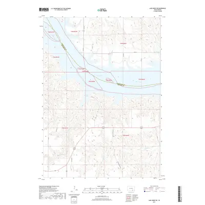
2017 Map of Lake Andes SW
USGS Topo · Published 2017About this map
Lake Francis Case and the wide channel of the Missouri River dominate this modern topographical study of the South Dakota prairie. The map documents the complex shoreline formed by the Missouri's impoundment, highlighting prominent inlets like Saint Phillips Bay and Joe Days Bay. The landscape beyond the water is defined by a dense network of coulees and drainages, such as Joe Days Cr and Randall Cr, which carve through the high ground of the Missouri Plateau.
Find a feature on this map
22 named features on this map. Tap any name to fly to it.
Don’t see what you’re looking for? This feature index may not catch every label — zoom into the map to look around manually.
Map Details
Editions of this 2017 Lake Andes SW Map
This is the sole edition of this map. No revisions or reprints were ever made.
Other maps of this area

1955 · Mitchell
USGS Topo · 1:250,000

1955 · O'Neill
USGS Topo · 1:250,000

1959 · O'Neill
USGS Topo · 1:250,000

1959 · Mitchell
USGS Topo · 1:250,000

1964 · Campbell Creek
USGS Topo · 1:24,000

1964 · Butte
USGS Topo · 1:24,000

1964 · Lake Andes NW
USGS Topo · 1:24,000

1964 · Fort Randall Dam
USGS Topo · 1:24,000

1964 · Gross
USGS Topo · 1:24,000

1964 · Lake Andes SW
USGS Topo · 1:24,000