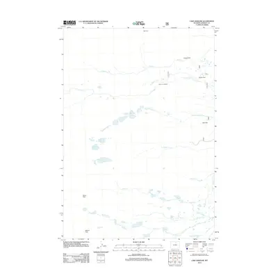
2012 Map of Lake Angeline
USGS Topo · Published 2012About this map
Lake Angeline and a high-elevation network of glacial waters define this 2012 survey of Johnson County. The landscape is dominated by the steep rises of Darton Peak and Bighorn Peak, which overlook a complex system of drainage including S Rock Cr and N Clear Cr. The map captures a wilderness area marked by remote landmarks like the Seven Brothers Lakes and the isolated Soldier Park. The concentration of water bodies at different elevations, from Lower Frozen Lake to the clusters of Chill Lakes and South Fork Ponds, suggests a terrain shaped by persistent ice and snow. Access into these higher reaches is shown via the North Fork Trailhead, connecting the low-lying basins to high points like Ant Hill and Triangle Park.
Find a feature on this map
35 named features on this map. Tap any name to fly to it.
Don’t see what you’re looking for? This feature index may not catch every label — zoom into the map to look around manually.
Map Details
Editions of this 2012 Lake Angeline Map
This is the sole edition of this map. No revisions or reprints were ever made.
Other maps of this area

1899 · Cloud peak
USGS Topo · 1:125,000

1900 · Fort McKinney
USGS Topo · 1:125,000

1901 · Cloud Peak
USGS Topo · 1:125,000

1903 · Fort McKinney
USGS Topo · 1:125,000

1955 · Sheridan
USGS Topo · 1:250,000

1958 · Sheridan
USGS Topo · 1:250,000

1962 · Sheridan
USGS Topo · 1:250,000
1967 · Willow Park Reservoir
USGS Topo · 1:24,000

1967 · Caribou Creek
USGS Topo · 1:24,000
1967 · Meadowlark Lake
USGS Topo · 1:24,000