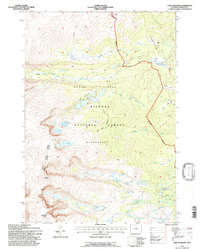
1993 Map of Lake Angeline
USGS Topo · Published 1997About this map
Bighorn National Forest serves as the backdrop for this high-altitude landscape, where the Cloud Peak Wilderness protects a network of glacial lakes and granite summits. The topography is defined by significant elevations like Darton Peak and Bighorn Peak, while the Solitude Trail provides a primitive passage through the high country.
Find a feature on this map
42 named features on this map. Tap any name to fly to it.
Don’t see what you’re looking for? This feature index may not catch every label — zoom into the map to look around manually.
Map Details
Editions of this 1993 Lake Angeline Map
This is the sole edition of this map. No revisions or reprints were ever made.
Other maps of this area

1899 · Cloud peak
USGS Topo · 1:125,000

1900 · Fort McKinney
USGS Topo · 1:125,000

1901 · Cloud Peak
USGS Topo · 1:125,000

1903 · Fort McKinney
USGS Topo · 1:125,000

1955 · Sheridan
USGS Topo · 1:250,000

1958 · Sheridan
USGS Topo · 1:250,000

1962 · Sheridan
USGS Topo · 1:250,000
1967 · Willow Park Reservoir
USGS Topo · 1:24,000

1967 · Caribou Creek
USGS Topo · 1:24,000
1967 · Meadowlark Lake
USGS Topo · 1:24,000