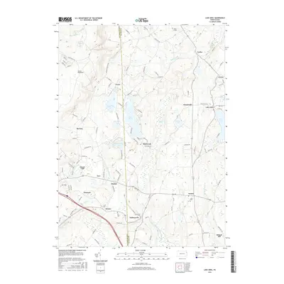
2016 Map of Lake Ariel
USGS Topo · Published 2016About this map
The Moosic Mountains dominate the western edge of this landscape, where the terrain transitions into a plateau dotted with glacial ponds and wetlands. Small settlements like Cortez, Maplewood, and Hollisterville are connected by a network of rural roads that skirt significant water bodies, including Lake Henry and Lake Ariel. This 2016 snapshot captures the region's enduring character as a recreational and agricultural corridor on the border of Lackawanna and Wayne counties.
Find a feature on this map
131 named features on this map. Tap any name to fly to it.
Don’t see what you’re looking for? This feature index may not catch every label — zoom into the map to look around manually.
Map Details
Editions of this 2016 Lake Ariel Map
This is the sole edition of this map. No revisions or reprints were ever made.
Other maps of this area

1889 · Scranton
USGS Topo · 1:62,500

1891 · Scranton
USGS Topo · 1:62,500

1892 · Honesdale
USGS Topo · 1:62,500

1892 · Dundaff
USGS Topo · 1:62,500

1893 · Scranton
USGS Topo · 1:62,500

1928 · Ariel
USGS Topo · 1:62,500

1932 · Ariel
USGS Topo · 1:62,500

1943 · Scranton
USGS Topo · 1:125,000

1943 · Honesdale
USGS Topo · 1:125,000

1946 · Olyphant
USGS Topo · 1:24,000
Featured Places
- South Canaan Township, PA
- Sterling Township, PA
- Lake Ariel, PA
- Drinker, Jefferson Township
- Wallenpaupack Mills, PA